ES:Calle San Guillermo: Difference between revisions
Jump to navigation
Jump to search
Content added Content deleted
m (→Gallery) |
|||
| Line 16: | Line 16: | ||
File:La_copa_G_2011.jpg|La Copa |
File:La_copa_G_2011.jpg|La Copa |
||
File:Mostazal_Sn_Gmo_sector_Dnde_Castillo_012.jpg|Al fondo Carretera 5 Sur |
File:Mostazal_Sn_Gmo_sector_Dnde_Castillo_012.jpg|Al fondo Carretera 5 Sur |
||
File:Sn_Francisco_Vista_del_Estero_desde_Sn_Guillermo_01.jpg|Puente Tronco sobre la Carretera 5 sur |
|||
</gallery> |
</gallery> |
||
Revision as of 18:13, 8 October 2021
Coordinates: 33°59′03″S 70°42′25″W / 33.98429°S 70.70696°W Calle san Guillermo es una de las vías de acceso a San Francisco de Mostazal Se extiende desde La Copa (por el Oriente) hasta avenida Independencia (por el Poniente), se continua con un pasaje Calle santa Filomena.
Gallery
-

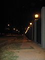
Nr.87
-

cruzando Condell
-

«El Rancho»
-

Nr 358
-

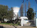
Padelpa Club at St Guillermo 373_W-Serrano str.
-

stadion Ernesto Meza Invernizzi
-
-

-

Colegio Gabriela Cruce Riquelme
-

Facade Colegio Gabriela Mistral
-

-
La Copa
-

Al fondo Carretera 5 Sur
-

Puente Tronco sobre la Carretera 5 sur


This page has not been added to any content categories. Please help out by adding categories to it so that it can be listed with similar pages. |