ES:Calle San Guillermo: Difference between revisions
Jump to navigation
Jump to search
Content added Content deleted
No edit summary |
No edit summary |
||
| Line 23: | Line 23: | ||
| style='border-style: none solid none solid;' | |
| style='border-style: none solid none solid;' | |
||
|- |
|- |
||
| style='border-style: none none none none;' | '''[[Riquelme]]''' (400) |
| style='border-style: none none none none;' | '''[[Riquelme]]''' (400)<gallery>File:RiquelMe s julia 20220815 G 2397.jpg|as viewed from St Guillermo</gallery> |
||
| style='border-style: none none none none;' | |
| style='border-style: none none none none;' | |
||
| style='border-style: none none none none;' | (400) |
| style='border-style: none none none none;' | (400) |
||
Revision as of 14:04, 16 August 2022
Coordinates: 33°59′03″S 70°42′25″W / 33.98429°S 70.70696°W Calle san Guillermo es una de las vías de acceso a San Francisco de Mostazal Se extiende desde La Copa (por el Oriente) hasta avenida Independencia (por el Poniente), se continua con un pasaje Calle santa Filomena.
| South side (even) | North side (odd) | |
|---|---|---|
 | ||
| Condell (200) | Pan de Azúcar  | |
| Karmel Estadio Municipal |
Beitia supermarket Padelpa Padelpa
| |
Estadio  | ||
Carabineros de Chile, Subcomisaria Mostazal |
||
Riquelme (400)
|
(400) | |
| F |  Donde Castillo | |
| Minimarket Esmeralda (500) | ||
La Copa  | ||

Gallery
-

Nr.87
-

Pan de azúcar hardware
-

cruzando Condell
-

-

«El Rancho»
-

-

Padelpa Club at St Guillermo Nr.373 W-Serrano street
-

stadion Ernesto Meza Invernizzi
-
-

-

Colegio Gabriela Cruce Riquelme
-

Façade Colegio Gabriela Mistral
-

Corvi al oriente
-

Donde Marcelita Supermarket, CORVI
-

Pasaje B
-

Minimarket José Luis
-

No.745
-
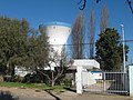
La Copa watertower
-

Al fondo Carretera 5 Sur
-

-

La Copa North end
-

Puente Tronco sobre la Carretera 5 sur


Gallery on Miraheze Commons
Weblinks
This page has not been added to any content categories. Please help out by adding categories to it so that it can be listed with similar pages. |