ES:Calle San Guillermo
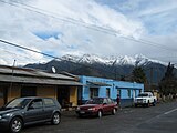
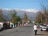
Coordinates: 33°59′03″S 70°42′25″W / 33.98429°S 70.70696°W Calle san Guillermo es una de las vías de acceso a San Francisco de Mostazal Se extiende desde La Copa (por el Oriente) hasta avenida Independencia (por el Poniente), se continua con un pasaje Calle santa Filomena.
| South side (even) | North side (odd) | |
|---|---|---|
 | ||
  |
  | |
| Karmel Estadio Municipal |
Beitia supermarket Padelpa Padelpa
| |
  | ||
Carabineros de Chile, Subcomisaria Mostazal  |
||
Riquelme (400)
|
(400) | |
| F |  Donde Castillo | |
| Minimarket Esmeralda (500) | ||
La Copa  | ||


Gallery[edit | edit source]
-

Nr.87
-

Pan de Azúcar, closed on 2022
-

Pan de azúcar hardware
-

cruzando Condell
-

-
«El Rancho»
-

-

-

Padelpa Club at St Guillermo Nr.373 W-Serrano street
-

stadion Ernesto Meza Invernizzi
-

-

-

Façade Colegio Gabriela Mistral
-

Corvi al oriente
-

Colegio Gabriela Cruce Riquelme
-

Donde Marcelita Supermarket, CORVI
-

Robertito por siempre
-

Pasaje B
-

Minimarket José Luis
-

No.745
-

La Copa watertower
-
Al fondo Carretera 5 Sur
-

-

La Copa North end
-
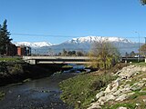
Puente Tronco sobre la Carretera 5 sur


Gallery on Miraheze Commons[edit | edit source]
Weblinks[edit | edit source]
This page has not been added to any content categories. Please help out by adding categories to it so that it can be listed with similar pages. |